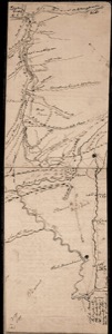
July 11, 1806
[Lewis]
the morning was fair and the plains looked beatifull the grass much improved by the late rain. the air was pleasant and a vast assemblage of little birds which croud to the groves on the river sung most enchantingly. we set out early. I sent the hunters down Medicine river to hunt Elk and proceeded with the party across the plain to the white bear Islands which I found to be 8 ms. distant my course S. 75 E.— through a level beautifull and extensive high plain covered with immence hirds of buffaloe.— it is now the season at which the buffaloe begin to coppelate and the bulls keep a tremendious roaring we could hear them for many miles and there are such numbers of them that there is one continual roar. our horses had not been acquainted with the buffaloe they appeared much allarmed at their appearance and bellowing. when I arrived in sight of the whitebear Islands [1] the missouri bottoms on both sides of the river were crouded with buffaloe I sincerely belief that there were not less than 10 thousand buffaloe within a circle of 2 miles arround that place. I met with the hunters at a little grove of timber opposite to the island where they had killed a cow [2] and were waiting our arrival. they had met with no elk. I directed the hunters to kill some buffaloe as well for the benefit of their skins to enable us to pass the river as for their meat for the men I meant to leave at this place. we unloaded our horses and encamped opposite to the Islands. had the cow skined and some willows sticks collected to make canoes of the hides by 12 OCk. they killed eleven buffaloe most of them in fine order. the bulls are now generally much fatter than the cows and are fine beef. I sent out all hands with the horses to assist in buthering and bringing in the meat by 3 in the evening we had brought in a large quantity of fine beef and as many hides as we wanted for canoes 〈covering〉 shelters and geer. I then set all hands to prepare 〈the〉 two canoes 〈in order to pass the river〉 the one we made after the mandan fassion with a single skin in the form of a bason [3] and the other we constructed of two skins on a plan of our own. we were unable to compleat our canoes this evening. the wind blew very hard. we continued our operations untill dark and then retired to rest. I intend giving my horses a couple of [4] days rest at this place and deposit all my baggage which is not necessary to my voyage up medicine [EC?: maria's] river.
ca. July 3–11, 1806, Codex N, pp. 149–50
[Clark]
Sent on 4 of the best hunters in 2 Canoes to proceed on a fiew miles a head and hunt untill I came up with them, after an early brackfast I proceeded on down a very crooked Chanel, at 8 a. m I overtook one Canoe with a Deer which Collins had killed, at meridian passed Sergt. Pryors camp near a high point of land on the left Side which the Shoshones call the beavers head. [5] the wind rose and blew with great violence from the S W imediately off Some high mountains Covered with Snow. the violence of this wind retarded our progress very much and the river being emencly Crooked we had it imediately in our face nearly every bend. at 6 P M I passed Phalanthrophy river which I proceved was very low. the wind Shifted about to the N. E. and bley very hard tho' much wormer than the forepart of the day. at 7 P M I arrived at the Enterance of Wisdom River and Encampd. in the Spot we had encamped the [NB: 6th] of August last. [6] here we found a Bayonet which had been left & the Canoe quite safe. [7] I directed that all the nails be taken out of this Canoe and paddles to be made of her Sides & here I came up with Gibson & Colter whome I had Sent on a head for the purpose of hunting this morning, they had killed a fat Buck and 5 young gees nearly grown. Wisdom river is very high and falling. I have Seen great Nos. of Beaver on the banks and in the water as I passed down to day, also some Deer and greater numbers young gees, Sand hill cranes &c. &c. Sgt. Pryor left a deer on the shore
[Ordway]
Friday 11th July 1806. a fair morning. we took breakfast eairly and Set off proceeded on the wind hard a head which is unfavourable to us. in the evening we arived at the mouth of Wisdom River. Camped [8] where we left the Small canoe last year. wisdom river is verry high at this time 2 hunters went out. Collins killed 2 deer and Gibson killed a fat buck this evening the beaver Sign and lodges without number all this day. they are pleantier in this valley than I have Seen on the route &C
[Gass]
Friday 11th. This was a fine morning, and we set out early to cross the point, [9] and having gone eight miles, came to the Missouri at the Bear islands, nearly opposite our old encampment. [10] Here our hunters, in a short time, killed five buffaloe; and we saved the best of the meat; and of the skins made two canoes [11] to transport ourselves and baggage across the river. The buffaloe are in large droves about this place.


