Lewis and Clark on the Great Plains A Natural History Maps
Map 1. Route of Lewis and Clark in Kansas and Missouri
Outward Route Schedule: June 29 to September 7, 1804
Return Schedule: August 29 to September 15, 1806
River Distance: Mouth of Kansas River to northernmost Nebraska-South Dakota boundary, estimated by Lewis and Clark as 691 river miles. Because of recent channelization and other river changes, the current distance is now substantially less.
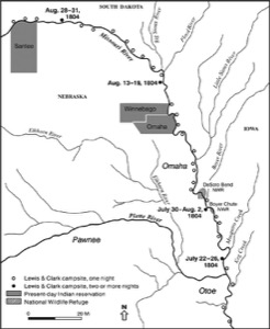
Map 2. Route of Lewis and Clark in Nebraska and Iowa
Outward Route Schedule: June 29 to September 7, 1804
Return Schedule: August 29 to September 15, 1806
River Distance: Mouth of Kansas River to northernmost Nebraska-South Dakota boundary, estimated by Lewis and Clark as 691 river miles. Because of recent channelization and other river changes, the current distance is now substantially less.
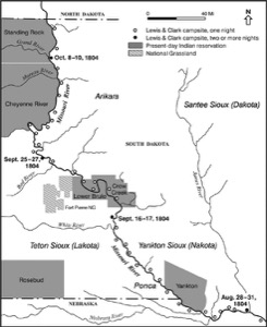
Map 3. Route of Lewis and Clark in South Dakota
Outward Route Schedule: August 21, 1804, to April 27, 1805
Return Schedule: August 3-5 to September 3, 1806
River Distance: Northernmost Nebraska-South Dakota boundary to present North Dakota-Montana boundary, estimated by Lewis and Clark as 830 miles. Because of recent impoundments and other river alterations, current river distances are substantially less than those encountered by Lewis and Clark.
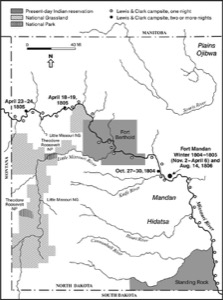
Map 4. Route of Lewis and Clark in North Dakota
Outward Route Schedule: August 21, 1804, to April 27, 1805
Return Schedule: August 3-5 to September 3, 1806
River Distance: Northernmost Nebraska-South Dakota boundary to present North Dakota-Montana boundary, estimated by Lewis and Clark as 830 miles. Because of recent impoundments and other river alterations, current river distances are substantially less than those encountered by Lewis and Clark. Clark estimated the total river distance from their starting point at Camp Wood to the Mandan villages as 1,500 miles, but it actually was closer to 1,600 miles.
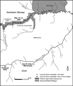
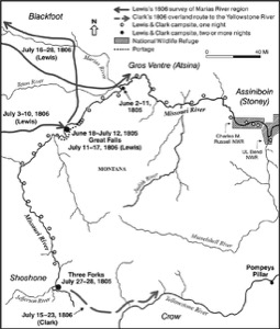
Map 5. Route of Lewis and Clark in Eastern Montana
Outward Route Schedule: April 27 to July 27, 1805
Return Schedule: July 7 to August 3 (Clark) or August 7 (Lewis), 1806
River Distance: Montana-North Dakota border to Three Forks, 945 river miles, according to Lewis and Clark. Because of recent impoundments, present-day river distances are now substantially less than the original distances calculated by Lewis and Clark.
Map 6. Route of Lewis and Clark in Western Montana as Far as Three Forks
Outward Route Schedule: April 27 to July 27, 1805
Return Schedule: July 7 to August 3 (Clark) and August 7 (Lewis), 1806
River Distance: Montana-North Dakota border to Three Forks, 945 river miles, according to Lewis and Clark. Because of recent impoundments, present-day river distances are now substantially less than the original distances calculated by Lewis and Clark.

